Land & Ranch Brokers
Use property intelligence as a professional listing and buyer-education tool.
Property intelligence
Brooks Geospatial turns scattered public GIS data into clear, property-specific research.
Our reports combine professional mapping with measured spatial analysis to help landowners, buyers, brokers, developers, investors, and consultants better understand a property before moving into more specialized due diligence.
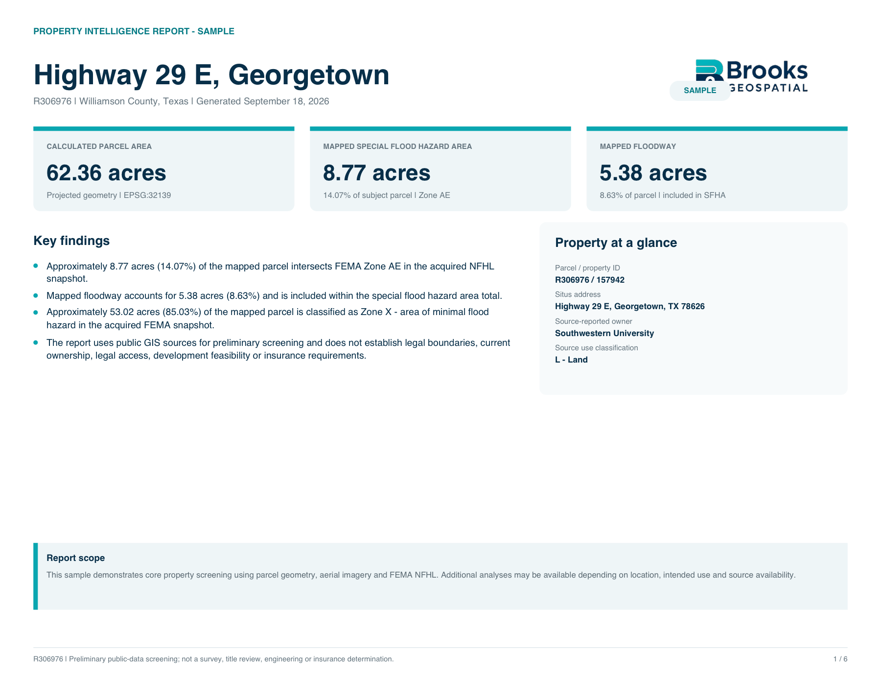 Sample Property Intelligence Report
01 / The work
A single property may require information from appraisal districts, FEMA, aerial imagery, local GIS systems, transportation agencies, soil databases, environmental datasets, and other public sources.
Property Intelligence Reports organize relevant information into one professional deliverable with clear maps, measured results, source documentation, and limitations.
Available data varies by location and intended use.
02 / Available analysis
Available analysis varies by property, geography, data availability, and intended use.
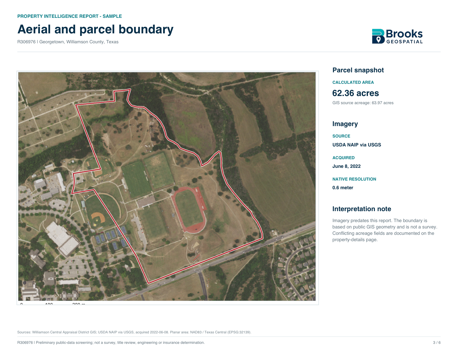
Parcel & aerial mapping
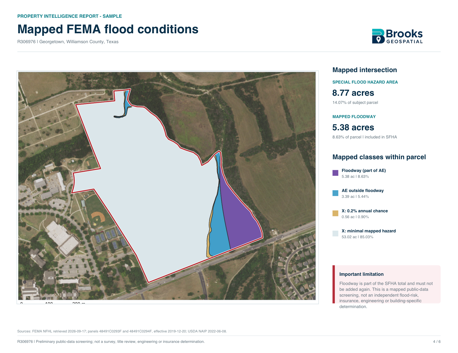
FEMA flood conditions
Terrain & slope
Soils
Mapped wetlands & water features
Road & transportation context
Groundwater information
Planning, zoning & jurisdiction data
Demographics & market context
Surrounding parcels / ownership context
Infrastructure information
Spatial measurements & calculated acreage
03 / Who it’s for
Use property intelligence as a professional listing and buyer-education tool.
Organize public information before committing to deeper due diligence.
Understand mapped conditions, access, demographics, planning context, and other site factors.
Receive an organized GIS research package before more specialized work begins.
Better understand the public GIS information associated with a property.
04 / Report options
Service categories are shaped around the property, the available public data, and the decision at hand.
Starting around $149
A concise property screen including parcel information, aerial mapping, FEMA flood analysis, key findings, and source documentation.
Request this reportStarting around $249
Expanded analysis using additional datasets appropriate to the property, potentially including terrain, soils, wetlands, access, planning/zoning, surrounding parcels, and other relevant layers.
Request this reportCustom quote
More detailed acquisition, development, commercial, site-selection, or multi-property analysis.
Request this report05 / A closer look
Core Property & Flood Screening
View Full Sample ReportProperty at a glance
The sample is a focused public-data screen—not the most comprehensive report possible. It shows how sources, findings, measurements, and limitations are communicated together.
Request a report
Send us the property address, parcel ID, or listing link. We’ll review available data and determine the appropriate report before work begins.
Property Intelligence Reports are preliminary public-data research products. They do not replace surveys, title review, engineering, environmental studies, appraisals, flood determinations, zoning confirmations, insurance determinations, or legal advice.
Report content varies by location and intended use based on the availability, currency, licensing, and suitability of public datasets.