Property intelligence / Georgetown, Texas
Turning scattered property data into one clear report.
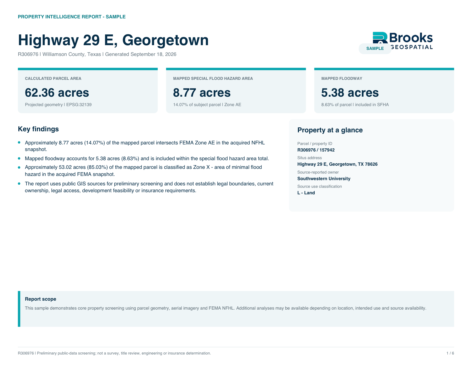
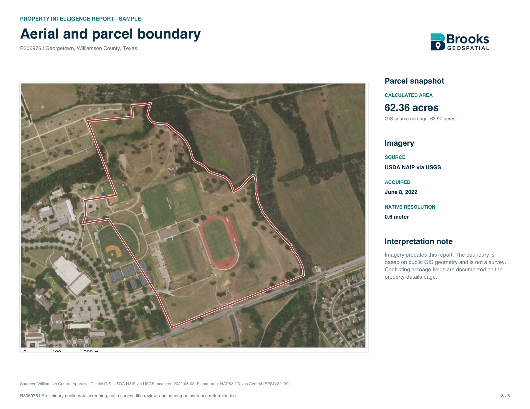
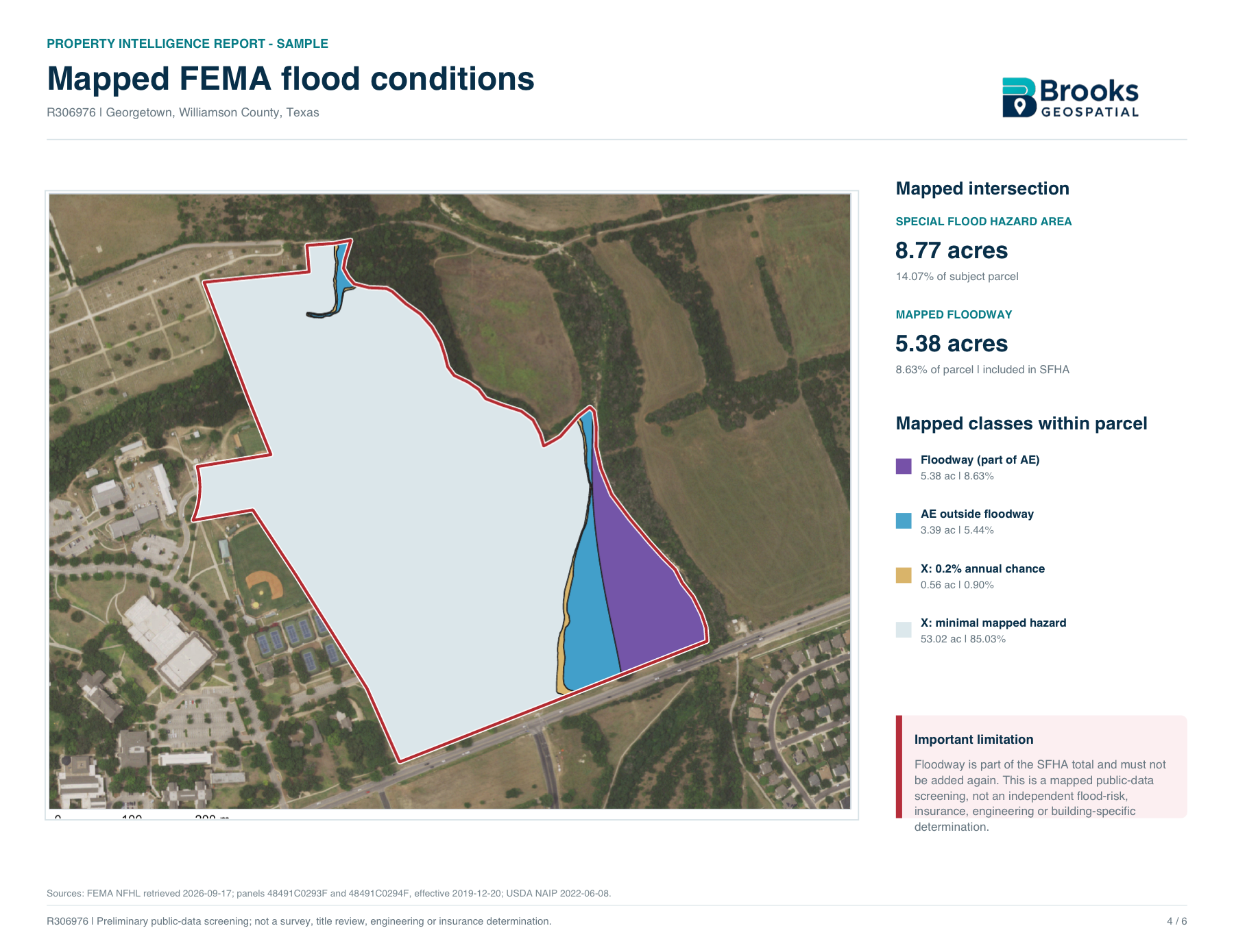
Parcel information, aerial imagery, mapped FEMA conditions, measured spatial analysis, and source documentation assembled into a concise property-specific research package.
The perspective
About the work.
- Property snapshot
- Aerial & parcel mapping
- FEMA flood analysis
- Source documentation
The sample report brings relevant public GIS research into a clear, property-specific deliverable. It combines a property snapshot, aerial and parcel mapping, measured FEMA conditions, source documentation, and practical limitations for preliminary land research.
Your next project starts here
Let’s put your project
in perspective.
A property to showcase. A site to understand.
A map that makes it all make sense.