Our Services
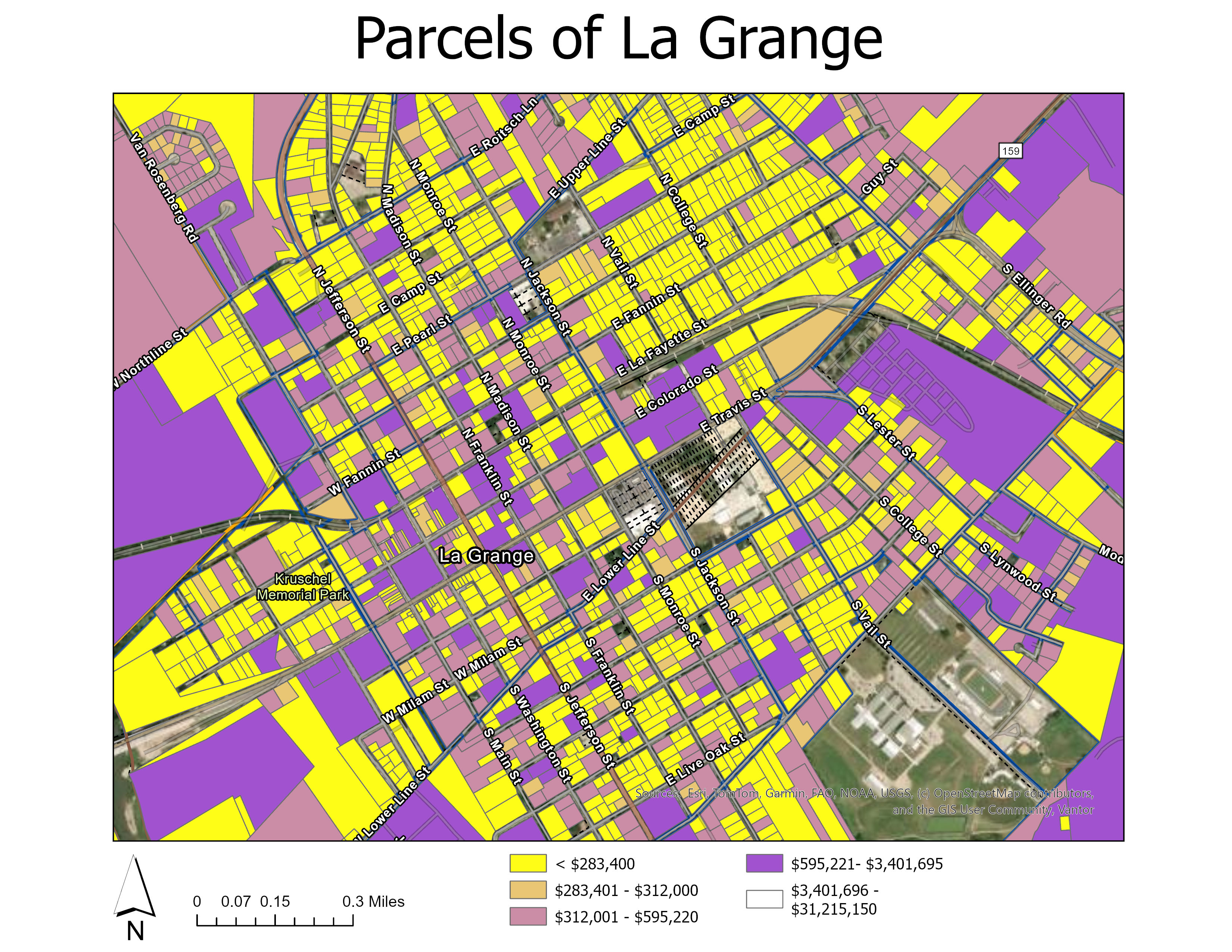
GIS & Mapping
Site surveys, progress tracking, and 3D modeling. Turning physical sites into digital assets.
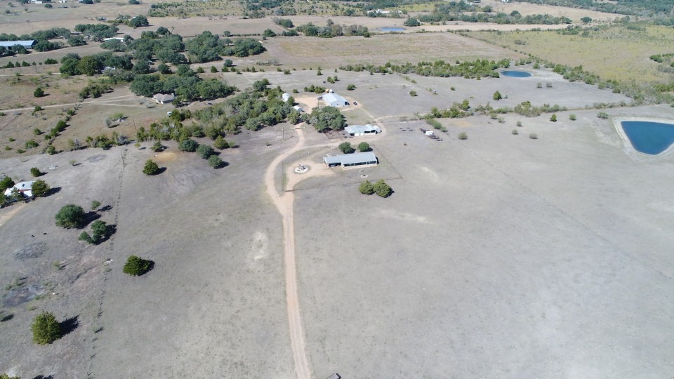
Aerial Imagery
High-resolution photography & videography for real estate marketing, events, and promotion.
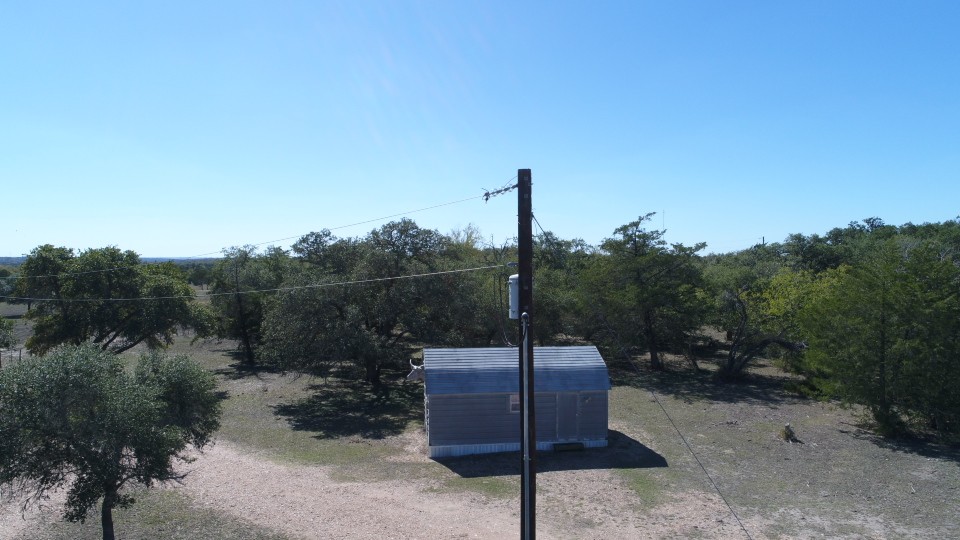
Utility Contracts
Detailed inspections, asset mapping, and vegetation management for utility infrastructure.